Lewis & Clark Trail to St. Joseph, MO, May 2003
[Return to the Kansas City Bicycle Log | my bicycle advocacy page | Missouri Bicycle Federation home page ]
In May 2002 I felt left out because some of the other local cyclists were bicycle commuting on "Ride to Work Day" and I couldn't figure out how I could do it. So for 2003, I decided figure out how to do it and make it happen.
I live in Raytown, Missouri, and work at Missouri Western State College in St. Joseph. This is about 65 miles by freeway, but on the route I finally bicycled it was almost exactly 85 miles each way.
The Route Problem
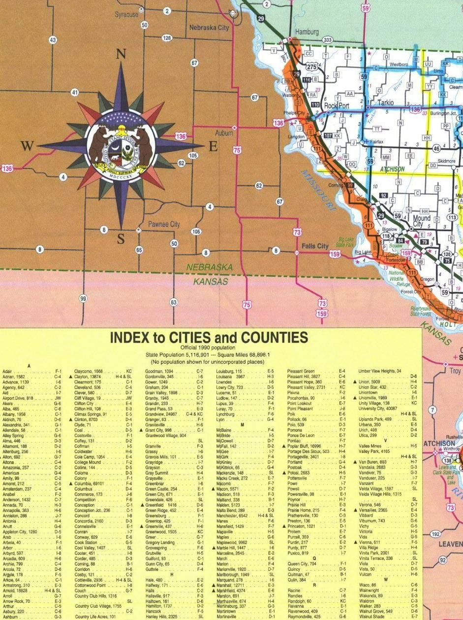
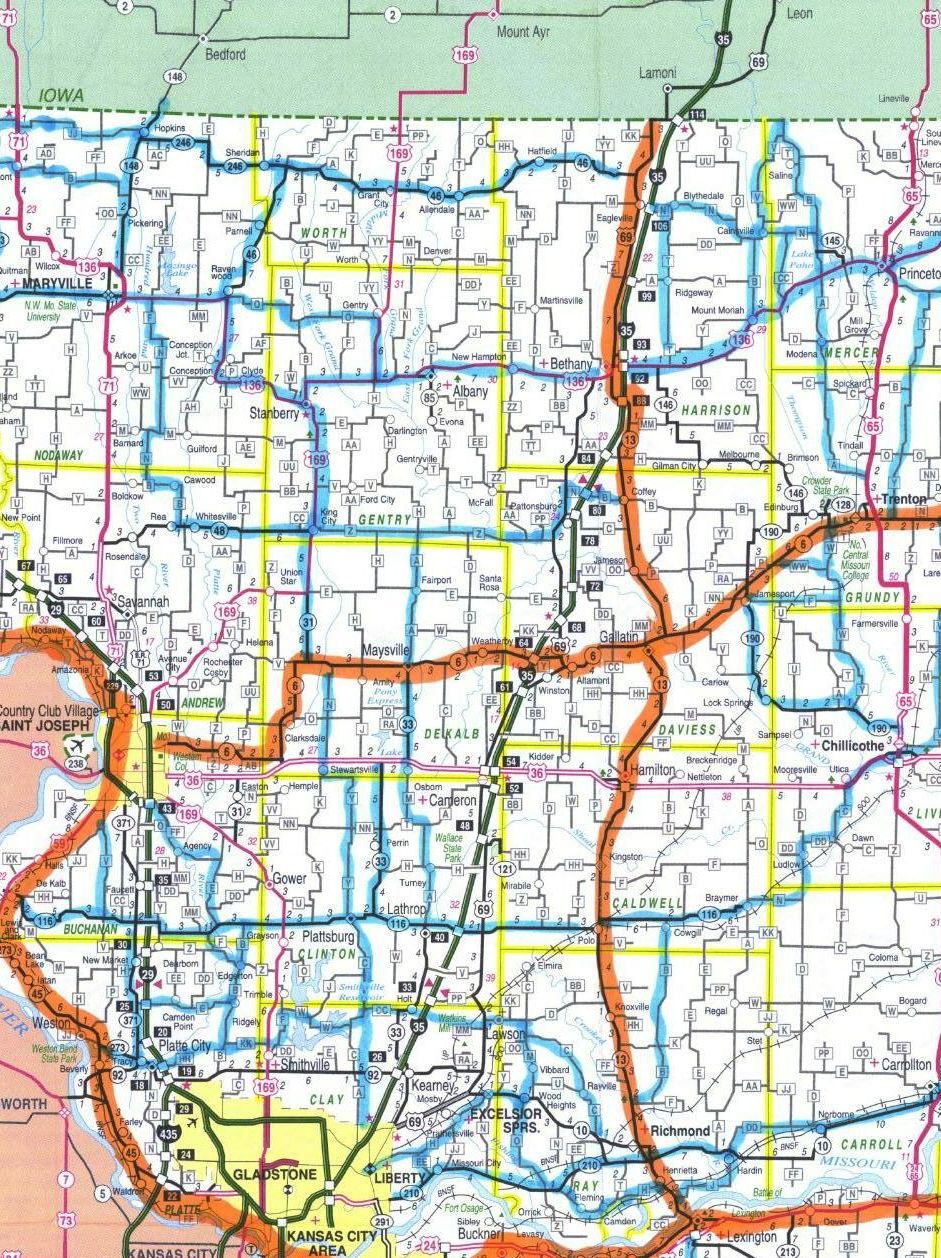
I had some difficulty in figuring out a reasonable route. Part of the difficulty is crossing the Missouri River. There really are no good ways to cross the Missouri in the Kansas City area. Two bridges are "more" cycle-friendly but each has difficulties. The Chouteau Bridge itself is beautiful for cycling, but the approaches on both sides are dreadful (although I have cycled them both a number of times). The Heart of America Bridge near downtown has a nice bicycle lane/shoulder going northbound (only) but there are some wild freeway-like interchanges on the northbound side if you're planning to follow the river northwest, as I was.Once across the river, there is still the question of which particular route to take. I was helped in my route planning quite a bit by having a look at the proposed Missouri cross-state bicycle route map. Some other Missouri cycling-related maps were also helpful.
The Lewis and Clark Route
In the end I decided to basically follow the Missouri River--the "Lewis and Clark Route". One reason was that I was involved in discussions about improving Adventure Cycling's Lewis & Clark Route through Missouri. The Adventure Cycling route crosses and leaves the river at Lexington, MO, proceeding north through Excelsior Springs and west through Platte City before rejoining the river. The reason for this route choice is to bypass the Kansas City metro area. But in doing so, the Adventure Cycling route misses over 50 miles of the river and of Lewis & Clark's route.Furthermore, the Adventure Cycling route crosses the Missouri River into Kansas at Atchison, and from that point much of the Adventure Cycling route north through Kansas is quite distant from the river.
Some members of Missouri's Bicycle/Pedestrian Advisory Committee worked out an alternative Lewis & Clark route that would follow the river more closely through the Kansas City area and then north along the Missouri River, mostly within the river's floodplain, through St. Joseph and finally to the state line.
| You can see an outline of this "improved" Lewis & Clark Route here and here (the L&C Route is the orange route that generally follows the river; JPG format). |
Because of this--and the fact that it is clearly the flattest possible route between KC and St. Joseph--I was anxious to try out this proposed Lewis & Clark route.
The Departure
I needed to be at work by 3PM on Thursday. Assuming a 7AM start, I was a little worried about making 85 miles by 3PM (speed isn't exactly my strong point, especially on a long ride, and I wanted to allow for any breakdowns or problems). So I arranged to stay Wednesday night with Randy Niere, a friend who lives in Kansas City, Kansas, about 17 miles from my house. That way I could ride the first few miles Wednesday evening and then be ready to leave, rested & refreshed, bright and early Thursday morning.
Of course, it didn't exactly work out that way.
I was planning to leave for Randy's house by about 6PM Wednesday, but had a series of problems with the bike and so on, and finally got on the road about 10:30PM. Then, even though I have ridden and driven all the roads about a zillion times, I managed to get turned around, confused, befuddled, and just plain lost about 10 times on the way. The highlight was when I saw a pair of policemen creeping stealthily around a church on 39th Street, looking for all the world exactly like a pair of TV cops,
 giving each other hand signals, peering around corners, and generally acting like they were stalking a murderer or escaped convict (just then, I later realized, is when I missed a crucial turn onto Roanoke).
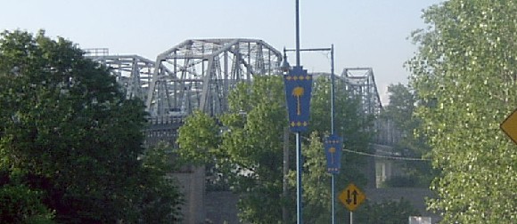
The Bridge
The next morning I was on the road by about 7:30AM. At Randy's suggestion I took the Platte Purchase Bridge (Hwy 69) across the Missouri. The bridge doesn't have any special bike lane or shoulder--just two rather narrow lanes. But if you catch it at the right time, there is very little traffic. It's near Ford's Fairfax plant in KCK and, as Randy says, if you should happen to catch it at shift change, then "Heaven help you". But otherwise, there is so little traffic that it isn't that bad. I managed to catch it a good times of day on both crossings. I just took the lane and I don't think I was passed by more than 4 or 5 cars on either crossing.As you can see, I was rather obsessed with this bridge. Here (above, right) was my first view of it, from near the Fairfax plant. (My Rans Rocket was made in Kansas, right here in the old US of A, so I'm pretty sure it doesn't fall under the threatened ban on "foreign vehicles" . . . )
Bridge approach:

Crossing the bridge:

Train tracks and levee in KCK from the Platte Purchase Bridge

The Missouri River from the bridge:

A look back at the bridge from the north side of the river:

(I did say I was obsessed with the bridge, didn't I?)
On the other side of the bridge, the best course is to take the first offramp, which leads into a casino and some other nearby businesses. I then worked my way north and about a half mile east to an interchange with Hwy 9. This avoids a nasty freeway-like interchange among Hwy 69, Hwy 9, and I-635.

Parkville
The first interesting stop, proceeding south along Hwy 9, is Parkville, home of Park College:
Oddly enough, Parkville reminds me of nothing other than Park City, Utah. The difference, of course, is that you have to climb a few thousand feet to get to Park City and after you get there you can climb a few thousand more getting to the top of any number of nearby peaks.
Parkville lacks nearby snow-covered mountain peaks (in their place we have toxic waste-covered mounds of garbage and a light frosting of congealed superfund sites [1, 2, 3, 4, 5] lining the river), but it is built into a steep hillside--thus the resemblance:


I ate a hearty breakfast at Papa Frank's Ristorante:

My plan for making 170 miles in two days without bonking was to eat a lot and don't push the speed. I started to put the first part of my plan into action at Papa Frank's . . .
I left Parkville via Hwy FF, which keeps close to the river, avoiding a lot of hills and a lot of traffic on Hwy 45, which has plenty of hills but no shoulders at this point. A view of the Missouri River valley from FF:

A Panoramic View
A panoramic view of the river valley from FF (the series of 5 photos takes in a 360-degree panorama, moving in a clockwise direction):


(Actually it's not quite 360 degrees, because the last photo or two would have been looking directly into the side of the river bluff, which was only about 20 feet off at this point--too close to get anything like a panoramic view.)
Highway FF
FF has a few nice views of the river:
The town of Waldron is found on FF. Don't plan on finding a hearty breakfast here--you're looking at pretty much the whole town right now:

Note that there is a short stretch of FF (a mile or two?) that is unpaved. Here is the last stretch of Hwy FF at the intersection with Hwy 45:

Highway 45
The hill not climbed:
This photo shows Hwy 45 stretching southeast from the intersection with FF climbs the river bluffs.
I continued on Hwy 45 in the opposite direction--towards the northwest. From this point to Weston, Hwy 45 keeps to the floodplain. At Weston the "Weston Bend" brings the river close to the bluffs, forcing the main highway to again climb the bluffs and go around. I was trying to avoid the bluff-climbing thing whenever possible . . .
The "green bridge" over the Platte River. I was well under the posted weight limit of 45 tons . . .

Looking back (south) from the Platte River bridge:

I wasn't exactly the slowest--or the widest--vehicle on Hwy 45 that day:


There is quite a steady stream of such agricultural vehicles on these rural highways.
Beverly, MO, the intersection of Hwy 45 and Hwy 92:

The Weston Cutoff
At this point, if you are at all interested in re-tracing Lewis & Clark, I strongly suggest taking the old "River Bluff Road" along the base of the river bluffs through Weston Bend State Park and into historic downtown Weston. Then continue on River Bluff Road (Hwy J) north out of Weston until you re-join Hwy 45 a couple miles north of Weston.This route isn't really marked on any maps--partly because a crucial bridge has been out until just recently. It is almost all on well packed dirt roads, although maybe 1/3 mile of it was a bit dodgy on a bike--recently graded and very soft. But the rest of it is perfectly good dirt road and a few bits are paved.
The route saves you a little mileage and a number of hills. Because of the rougher surface, it is doubtful if you will save any time. But the scenery is well worth it . . .
The entrance to the "Weston Cutoff", along an old river bluff road, is this dirt road that terminates at this stop sign, at the junction of Hwy 45 and Hwy 92:

Opposite view of the same stop sign:

It says it is a "dead end" but it isn't. A short distance after the "dead end" sign, bear to the right. After another short distance you cross a brand-new bridge over a creek. Lacking this bridge, it certainly was a dead end:

Here I am, on the new bridge. As you can see, I still have the strength to smile. At this point, that is either a very good--or a very bad--sign. (This photo was taken on the return trip.)

Originally this was a river bluff road but it is now a dedicated and posted bike trail. It is part of a multi-use trail route, planned by Platte County, along Missouri river from Riverside all the way north to the county line (and then, presumably, to be extended by Buchanan County all the way to St. Joseph). Because the river cuts in right along the bluffs, the road is often cut partway up the bluffs. It offers some stunning views of the river:


Much of this trail, through Weston Bend State Park, is reminiscent of the most scenic stretches of the Katy Trail:


Weston
The trail emerges in downtown Weston. During the mid 1800s, Weston was right on the river. It was an important port and trading center. A flood moved the channel across the flood plain--about two miles from the previous port--and that dried up a lot of business. Most of the downtown buildings date back to the late 1800s, the town holds more than 100 antebellum homes, and 22 blocks of the city was made a National Historic Trust. It's well worth a stop.If you take Hwy 45 up and over the bluffs, you see the "high" part of Weston, which is a grocery store, a gas station or two, and a Subway sandwich outlet. That's why I recommend the low road . . .

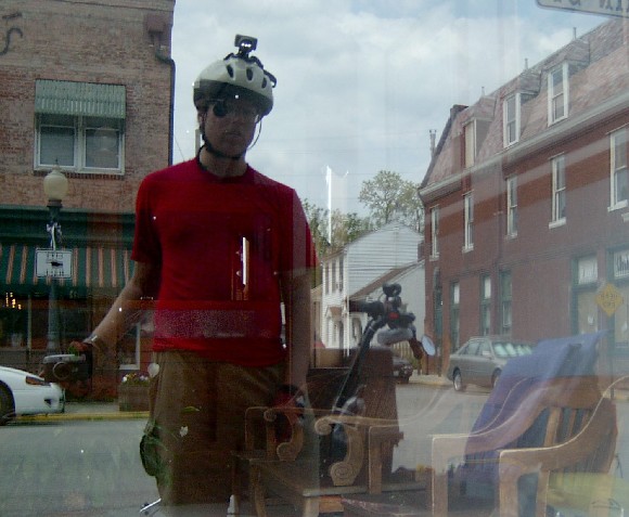
My try at an "artistic" self portrait (I guess I was inspired in my artistic endeavor by all the nearby shops selling quilts, stuffed animals, mugs, wallpaper, painted statuettes, and other, uh, gift items):
A flower planter makes a convenient place to park the bike:

Bluff Road North of Weston
Finding the bluff road out of Weston to the north is a bit tricky. I believe it is signed as Hwy JJ. There are a few turns as you leave the downtown area and ride through a neighborhood. The road follows a line just at the bottom of the river bluffs, so that makes it easy to find.
Two views of the bluff road north of Weston (note that it is unpaved):


Highway 45 Again
Now we're back on Hwy 45. Here is the entrance to the Snow Creek Ski Area [official web site]:
Now after all of you who live in actual mountainous areas have recovered from your gales of laughter at the thought of a ski resort in Missouri, remember that it's not TALL here, but it can be very STEEP and RUGGED. So you have the potential here for a very short, but very exciting run. I won't try to explain it any further than that . . .
Lewis & Clark State Park on Lewis & Clark Lake:

And there's Lewis right there! Or is it Clark? Whichever it is, it looks like he's just on the verge of exploring something very interesting . . .

The intersection with Hwy 138 to Atchison. As you can see, Hwy 45 picked up shoulders in Weston. Between Hwy FF and Weston, without shoulders, it didn't seem much of a problem Thursday morning, but returning, on Friday afternoon, there was just enough traffic in both directions to make it a bit uncomfortable (the traffic count map lists it as about 1200 vehicles per day). From Weston to St. Joseph there is even more traffic but also fairly continuous (if not necessarily continuously smooth and well-maintained) shoulders. The shoulders do completely disappear at occasional, usually short, points like bridges and viaducts.

As you can see, most of the route stays right in the riverbottom.

Highway 59
After the turnoff the Atchison the road becomes Hwy 59. A fair percentage of Hwy 59 has rumble strips like these:


Note the Christmas decorations:


This is the only other cyclist I met on Hwy 45 or Hwy 59:

This bridge pictured above was unusual in that the shoulders continued across it. But note the nice bike-eating grates they installed to make up for the momentary lapse of judgement in laying down all that "unnecessary" pavement:

Now here's the spirit of Missouri boiled down to its very essence: in the foreground history, in the background beautiful scenery and lush vegetation, but dominating the middle ground a big ugly junkyard. For your health, please do not walk, drink, or breathe in this area:

Another Bypass
Hwy 59 has one long, shoulderless, curving viaduct over railroad tracks that I would avoid if possible. It is about 4 or 5 miles south of the southern boundary of St. Joseph. Traveling north, if you take Bethel Road (pictured here), cross the railroad tracks, and then take the bluff road north you will bypass the dreaded viaduct completely, emerging just north of it. The only trouble with this is that you must turn off before the viaduct is in sight, maybe 1.5 or 2 miles before the viaduct (the viaduct is just out of sight on the other side of the hills in this photo):
I rode the viaduct going north, so it is certainly possible to do so, but going south I was anxious to bypass it if possible. Going south the detour was pretty obvious, since the bluff road takes off very near the viaduct (and actually passes underneath it).
This little barn was along the bluff road. The road was a rather bumpity (as you can see) and after a while, unpaved (which was not necessarily worse . . . ):

Again, I wasn't exactly the slowest or the widest . . .

St. Joseph
Aaaaaah . . . civilization:
On second thought, make that "Aaaaaargh"--south St. Joseph isn't exactly the poster child for the "City Beautiful" movement.
On the other hand, St. Joseph's Parkway is:

The multi-use trail pictured above winds its way through much of St. Joseph. I was curious to have a look at it, so I rode a bit of it on the way out of town. The "No Motor Vehicles" barriers are about the most reasonable I've seen on a trail of this sort--they don't threaten to unseat you, impale you, or slice your arm open if you should happen to rub against the (invariably too narrow) opening.
Aha, at last my goal! The Fine Arts Center at Missouri Western State College:

As you can see, I am so happy to be there that I can scarcely restrain myself from rushing in immediately and going to work, work, work . . .
I arrived almost on the dot of 2:00PM. I showered and changed in the nearby PE building.
The Return
After working during the afternoon and attending a meeting in the evening, I stayed at a friend's place for the night. I got off to a bright and early start the next morning for the return trip, hitting the road not a bit later than 1PM . . . well, maybe it wasn't such an early start, but I did get a good night's sleep, which I sorely needed, and also a bit of work done in the morning before I left.Despite my late start, I made pretty good time and figured I could easily make it home before dark. But after crossing the Platte Purchase Bridge, then getting horribly lost at the south end of the Fairfax Trafficway, I decided I'd better stop and have a chat with Randy and Kat.
(The difficulty with Fairfax Trafficway was caused by one of my favorite Missouri/Kansas Pet Peeves--inadequate, unclear, or simply nonexistent road signage. Both lanes of the trafficway start to go up a viaduct and at that point, according to the signs, the only options seem to be "left lane I-70 East" or "right lane I-70 West". I was stopped in my tracks because I wasn't very anxious to merge onto the freeway--either direction--at the 3.5MPH I would be doing on those steep viaducts. Yet I couldn't figure out any other way out of the area than the viaducts across the railroad tracks. I had come in this way, but it is a very confusing system of one-way over- and underpasses and it is impossible to exit the precise way I entered. Finally, after consulting my extremely detailed but still un-helpful map, I just took the leap of faith, only to discover the fact not made crystal clear in the signage, that it is possible yet not required for vehicles traveling in the right lane to take another, separate off-ramp that leads to I-70.)
After this fine misadventure, less than 1/2 mile from Randy's house, I then made a wrong turn on the bluffs, taking a street that has something like a 30% grade. I knew there was a more reasonable route, but I thought, "What the heck--I've got the legs to do it" so I just shifted into the lowest gear and spun my way up.
After spending a little while (ahem, cough, cough) chatting with Randy & Kat, I headed home, intending to take Cliff Drive. After crossing the infamous James Street Bridge, I took the lower level of the 12th Street Viaduct, then Beardsley Road to 5th Street, which eventually turns into Independence Avenue. There wasn't too much traffic so I decided to just take it straight across. Taking Winner Road around into the Blue River bottoms I figured I was within about 4 or 5 miles of home--and these are miles and a route I ride almost every day.
Coming to one of the two railroad tracks that go through the bottoms, though, I came across this:

This train was at a dead stop. You can clearly see the pout this caused to come across my face. After I waited 5 or 10 minutes there was still absolutely no sign of movement at all.
Finally I decided it just was not going to move, so I rode up out of the bottoms and crossed on the Truman Viaduct. Quite an annoying way to end the ride . . .
Summary & Stats
This 2 1/2 day ride was just part of the "Bike/Ped Commuter Challenge" week in Kansas City.Between Monday and Friday that week I rode a total of 297.4 miles, or an average of 59.5 miles per day.
Altogether this took 23 hours actual riding time, rolling average 12.9 MPH.
Monday: 66.6 miles, average 13MPH
Tuesday: 40 miles, average 14.4MPH
Wednesday morning: 20 miles, average about 15MPH
Most of the above was riding the Rans Screamer tandem, with Jan half the time (delivering her to work or picking her up), then alone the other half of the time.
Total mileage for the St. Joseph trip (Wed-Thurs-Fri) was 170.8 miles. Rolling average, according to the speedometer) was 12.4 MPH. I was loaded down pretty well on the St. Joseph trip (if you can go two days you can go a week and if you can go a week you can go indefinitely . . . ). I found, just as the bike touring types say, I could "make" almost exactly 10 miles an hour, including rest breaks, as long as rest breaks weren't 3 hours long like when I stopped at Randy's Friday . . .
As I said, on the long ride I tried to keep up on the eating and drinking and I just rode at a comfortable speed without trying to push it. I brought a bunch of bars that are loaded with carbohydrates and munched them all along the way; but you have to understand that even eating two or three of them every 10 miles still leaves you with a tremendous deficit (a person expends about 500 calories cycling 10 miles and the bars are about 120 calories each). After a certain number of miles my stomach starts to feel a bit queasy and I don't want to eat. Nevertheless I kept eating and drinking just a little at a time and it paid off.
I felt pretty happy with both speed and endurance--considering, by way of contrast, my "world's slowest century" of just last summer. That day I wasn't really planning to do a century, so I rode the first 25 or 30 miles at a very fast pace for me (over 15 MPH), didn't eat enough soon enough, bonked terribly about mile 40 (just in the middle of "Happy Hollow Road" which was full of hollow after hollow but not a one of them was happy as near as I could tell . . . ), then, after eating, semi-recovered enough to finish the hundred miles at about 11:30PM with an average of something like 9.5MPH.
So 180 miles at 12.4MPH was a pretty hefty improvement.
If I can keep up that rate of improvement, I'll be challenging Lance in only 3 or 4 more years . . .
[Return to the Kansas City Bicycle Log | my bicycle advocacy page | the Missouri Bicycle Federation home page ]