Go to: Son of Khan Server Stats - Mission Server Stats - Genghis Khan Server Stats (previous campaign archive) - Older Stats Archive
Visit TWCPilots.com for more information about TWC and the TWC servers.
Tobruk Route Plotting Map (plotting/planning only) - English Channel Route Plotting Map (plotting/planning only)
The General Situation Map is designed to duplicate much of the functionality--and also many of the disadvantages and blind spots--of an early WWII-era General Situation Map based on radar returns and observer reports.
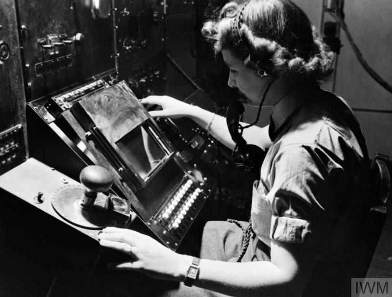
Radar operators went through a complex, time-consuming, and somewhat error-prone process to determine the bearing, altitude, distance, and possible makeup of each individual radar contact. Then a somewhat complex calculation was required to determine the contact's actual grid coordinates, altitude, and bearing. This information was collected and collated by a large team and plotted onto a local radar plot table, and then transmitted via telephone to a central location. At the central location, where another even larger team worked to assemble information collected from various outlying radar facilities, combine that information with observer reports, and resolve descrepancies between various radar & observer reports to create a unified overall view of the battlespace.
All this was done with amazing speed and accuracy. But even at best, each step took many seconds to a few minutes--a far cry from the computerized response time we are used to in the modern world, where communications speed is measured in gigabits and milliseconds, not individual contacts and minutes.
This is the view that the TWC General Situation Map is designed to replicate.
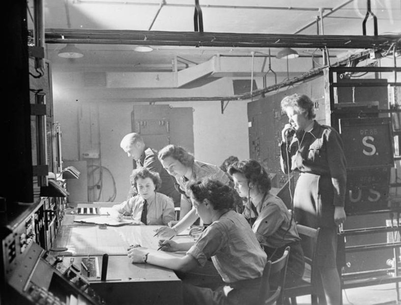
From this central contact plot, information was relayed--again by telephone--to local command headquarters, where the plots were again duplicated on a plotting map, and from there instructions were relayed to pilots in the field.
Considering the complexity, large dispersed team and equipment required to gather and collate data, and the vast distances involved, the system worked relatively smoothly and quickly.
Nevertheless, by today's standards the system was very, very slow. Response time from plot detection to combat pilot update was measured more in minutes than in milliseconds.
So you will find that the TWC General Situation Map transmits and updates data much, much slower than other modern 'radar screen' type game applications you may be familiar with. It is simulating the pace of information updates in a WWII environment--and, if anything, is far, far faster and more responsive than such systems were in real life.
The RAF history estimates the time from radar contact to information at local command headquarters at about four minutes, which is astonishingly fast--and was probably more-or-less a best case scenario. The TWC General Situation Map generally has updates to the operator in about two minutes--so about twice the best speed of the actual Chain Home system.
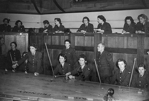
According to the RAF history, the type of order commanders would give based on contact plotting map data was “Scramble 92 and 72, Patrol Canterbury, Angels 25", which meant that those squadrons were to climb to 25,000 feet and form a patrol line over the city of Canterbury.
With today's modern radar, we might expect to be able to radio a pilot "You've got an enemy on your six. Turn hard right NOW!" With the WWII-era plotting table system, commanders simply did not have information that specific or timely. Rather, they would be able to provide pilots in the field with a best estimate of the general location enemy aircraft might be 5-20 minutes in the future, based on radar and observer information that was collected 4-20 minutes previously.
So, the contact plotting table gives an overview of the airspace similar that available to air commanders in some early WWII-era battles, and can provide invaluable strategic insights.
But don't expect it to provide the sort of instantaneous and smooth updates you see in a modern aircraft or gaming 'radar' style display.
An excellent description of a WWII contact plotting system in action can be found at the Wikipedia article on Great Britain's Chain Home system.
Go to: Son of Khan Server Stats - Mission Server Stats - Genghis Khan Server Stats (previous campaign archive) - Older Stats Archive
Visit TWCPilots.com for more information about TWC and the TWC servers.